Early Winter Outlook
Published: 6 October 2025 | Author: CESTOF
So as we all know, winter is infront of us, so lets see how will the winter look.
What is influencing winter
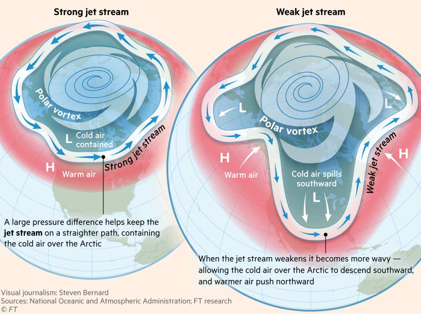
To know what are going to be the average temperatures during winte, we first need to look at the most important thing in predicting the winter, The Polar Vortex. Polar vortex is a huge area in around 20.000 meteres that spins and keeps in cold arctic air.
Polar vortex is a huge area in around 20.000 meteres that spins and keeps in cold arctic air, and is heavily influenced by the jet stream. Most of the times the vortex keeps the cold air inside but sometimes it weakens and spills the cold air into Europe.
This is called the Sudden Stratospheric Warming (SSW), and what happens is a sudden increase in stratospheric temperatures, which weekens the vortex and spills the cold arctic air into the mid-latitudes
So what are going to be the temperatures
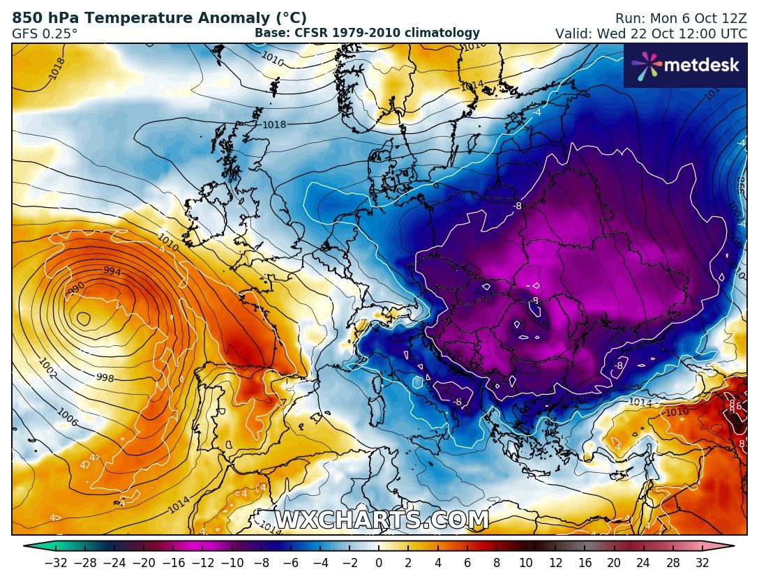
The Polar Vortex will most probably weaken and will spill all the cold air to europe as we can see on this forecast from the GFS model
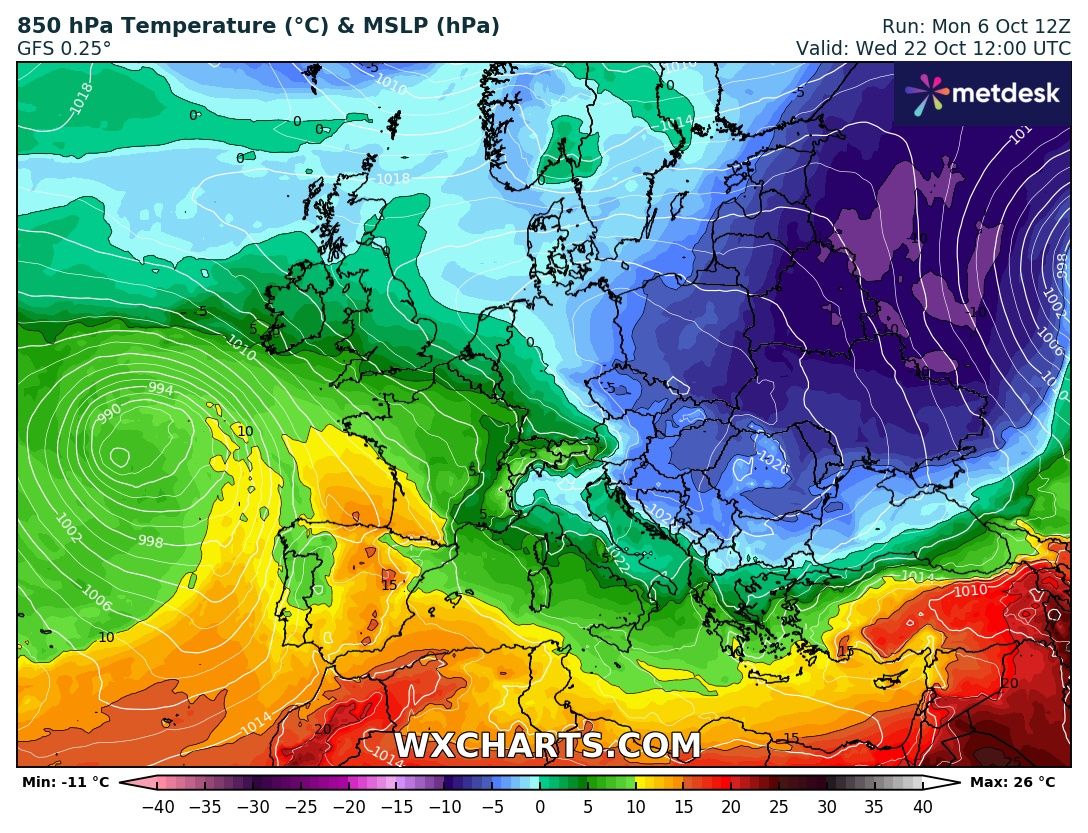
So in Central Europe to Eastern Europe will the temperatures be around 5 celsius, but the higher atitudes around 850hPa (which is 1500 meters) will have -5 celsius which could produce snow.
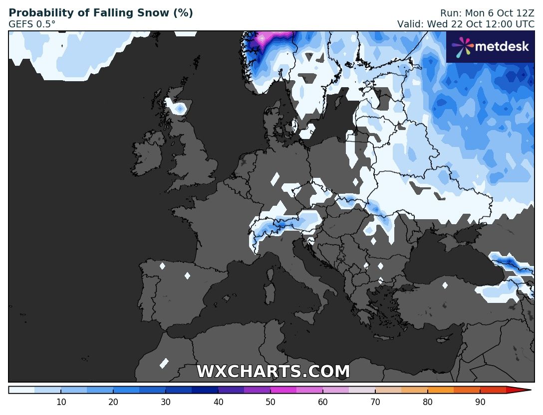
More updates and later snow forecasts for Central Europe.